
Hiked Mt Sherman (14,035) on July 18th 2020 from Iowa Gulch Trailhead
An invite to camp for the weekend brought us to Twin Lakes, Colorado – a perfect opportunity to bag some 14ers. As it was one of our companion’s first 14er attempt, we opted for the 5 mile Mt. Sherman from Iowa Gulch Trailhead. While the hike is not particularly long, the elevation gain of 2,200 feet is not to be underestimated.
This was new territory for us as we are typically at a 14er trailhead before 5AM, but today we didn’t begin our hike until 8AM. It was a 45 minute drive from our campsite, and the last three miles to the trailhead are along a bumpy dirt road. While a low clearance vehicle could make it traveling slowly, I decided not to risk it in the Hyundai Accent and we hopped into our friend’s car. The trailhead was packed and we parked down a ways along the road.
Video of our Summit Hike to Mt. Sherman
There is no signage indicating the start of the trail and I would recommend keeping an eye out for a trail on the right starting with a steep slope down. (We actually met a couple on our return trip who missed the trail entirely and spent two hours doing a completely different hike)! The AllTrails app was helpful in this situation.
The beginning of the trail is relatively flat and meanders through the bushes. Some spots had puddles covering the entire trail and there was considerable amounts of mud – we had to bust out some interesting moves to avoid getting our feet wet. After passing through the shrubbery we walked through a small meadow filled with wildflowers.
There were Blue Columbines growing together in bunches surrounded by Indian Paintbrushes, Tansy Asters, Subalpine Larkspur and Alpine Buttercups. In my opinion, the copious wildflowers with the mountain backdrop was the best view of the hike.

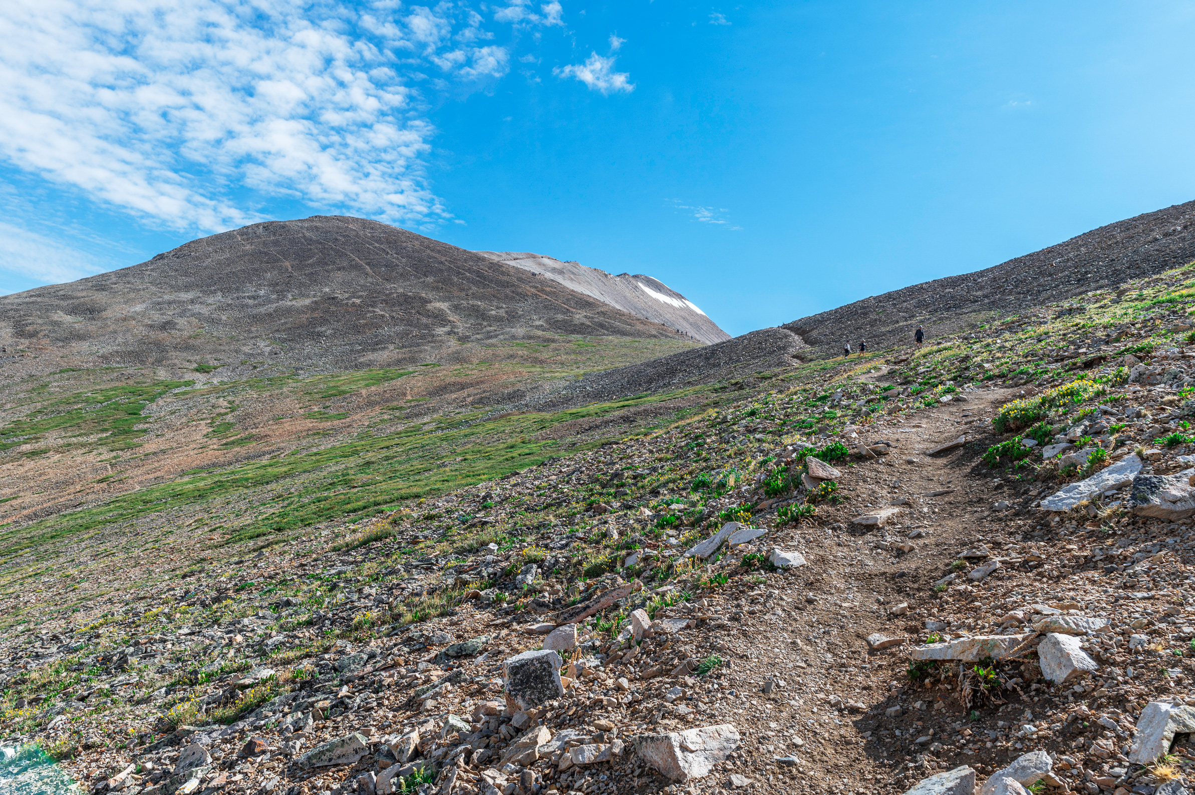
It was not long before we exited the grassy area and found ourselves hopping along boulders. It’s easy to get off trail here and we found ourselves several feet above the actual path on our ascent. Thankfully we were able to reconnect after a short spell. Upon reaching the rocks the elevation gain begins in earnest. The trail navigates through some switchbacks up to the ridge, but mostly it’s a climb straight up.

Ridge of Mount Sherman (13,100′)
At the ridge the trail connects with the Four Mile Trail coming from the other direction. A left hand turn leads up to the summit of Mt. Sherman, while a turn to the right travels up to neighboring 13er Mt. Sheridan. While Sheridan looked appealing due to the lack of foot traffic, we continued left. The trail continues straight up without many switchbacks. You have approximately 900 ft of elevation gain to go once you get to the ridge line.

The section from the ridge to the summit was increasingly crowded due to the two trails merging. In places the trail is narrow and has steep drop-offs on both sides, making it difficult to pass other hikers.

It was frustrating when people took a rest right in the middle of the trail, and sometimes we had to get creative to avoid them. It certainly is not a suitable trail for social distancing. This part was quite windy, though the summit was not.
Summit of Mt Sherman Elevation 14,035 ft
We ascended one false summit, then it was a short trek to the true summit. If our trip up was any indication, the summit itself was exceptionally crowded. Though I don’t think it’s possible for views to be bad on a 14er, this one was not as scenic as other mountains we had climbed.

We were the first to reach the top of our friend group, so after taking some GoPro footage we settled in to wait. The trip up had taken us just under two hours.


After celebrating our group accomplishment, we snapped some photos and began our descent – we did not want to get caught in a storm. The trip down may have been more difficult than the one up because the rocks were very slippery. Even wearing our good hiking shoes we found ourselves slipping a few times. It was a relief to reach the boulder field, giving our knees and toes a break.
It was a short walk back through the meadow and the bushes; luckily we didn’t get hit with any weather. After driving back down the three miles of dirt road, we gulped down a celebratory beer at Two Mile Brewing Co. and returned to the campsite. The hike in its entirety took us just over 3 hours (moving time), and 4 hours total.
While we were proud of our accomplishment and happy to add Mt. Sherman to the list of completed 14ers, I would not recommend this hike to people staying in the area. There are several other mountain hikes in the Twin Lakes/Leadville area that are much more scenic and much less crowded. However, this is a good trail for a beginner 14er.
Leave a Reply
You must be logged in to post a comment.