For three months we have been anxiously awaiting our first backpacking trip of the year in Rocky Mountain National Park – a two night stay at Lost Lake campground. This year, due to the high number of visitors to the park, persons interested in wilderness camping needed to enter a lottery to be randomly selected. The Rocky Mountain site experienced continued breakdowns when wilderness camping permits were released which led to this updated procedure. Only one person per household could enter the lottery, and those who were selected received an email with a link that expired within 24 hours. Lottery winners were emailed the link on a staggered basis, and I was lucky enough to receive a lottery email on March 25th, 2021.
Upon receiving the email, I quickly accessed the wilderness camping webpage and made our future camping selections. Due to the staggered release of lottery winners, some campsites were already booked up for the entire summer season; we were sad to see Little Rock Lake and Bluebird Lake campsites were completely full. However, we were able to capitalize on availability at Lost Lake from July 3rd– July 5th, Chipmunk Lake August 28th, and North Inlet Junction September 4th-September 6th. At first, this area was closed to hikers entirely due to the Cameron Peak Fire last summer which caused us a good deal of stress. Roughly a month prior to our departure we learned that the area had been reopened to the public and we were able to keep our original plans.
Video of Our 3 Day Wilderness Camping trip at Lost Lake
Camping permits can be collected from the wilderness office in Rocky Mountain National Park within one month of your camping date. After our Mount Ida hike, we stopped by the wilderness office at Beaver Meadows – this office is open daily from 9AM-3:30PM. Last year I was required to watch a safety video and pass a quiz prior to receiving the permit, but this time around I did not. Unfortunately it was too early to pick up our other camping permits at this time.
We spent the week leading up to our trip assessing our current gear and supplementing as needed; we also purchased freeze-dried meals online and picked up snacks at the store. Rereading sections of Lisa Foster’s guide book and studying maps on AllTrails helped us determine our route to the campsite and plan our day hikes. According to AllTrails, the total mileage from the trailhead to Lost Lake is 9.7 miles with 3,200 feet of elevation gain. After loading our gear into the car, we left Denver around 5:45AM. We took I-25 North to Loveland, then took route 34 to Drake and turned right onto County Route 43.
Six miles are spent along on CR-43 before a right-hand turn onto Dunraven Glade Rd. Another 2 miles along this dirt road and we were at the North Fork Trailhead. There were several cars in the parking lot already, but it looked as if they had been parked overnight. One other group of four pulled into the parking area at the same time as us; they were also camping at Lost Lake. There is a vault toilet at the trailhead and a decent amount of available parking.
Hiking to Lost Lake from Dunraven Trailhead
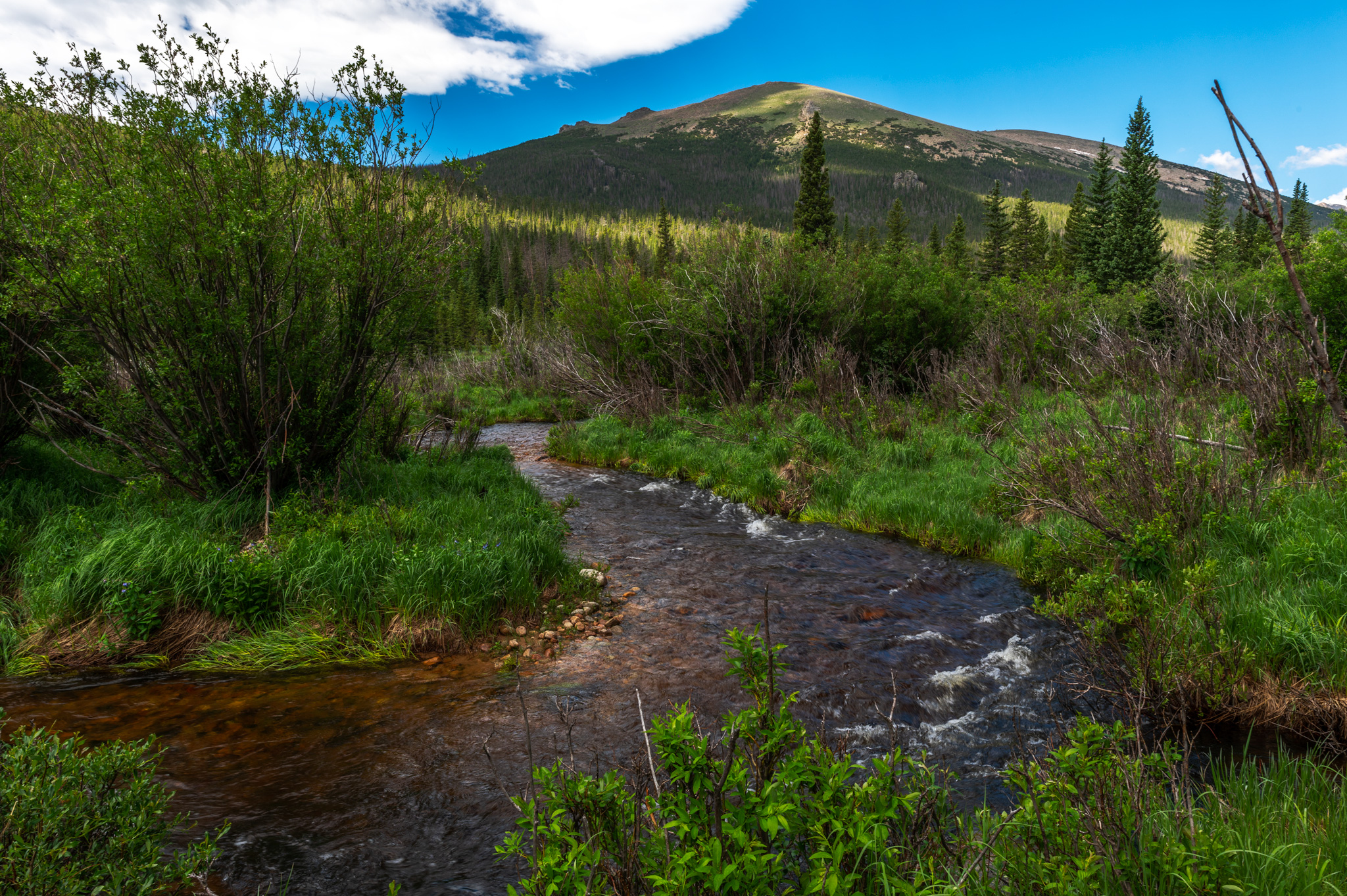
Dunraven Trailhead is not within the boundaries of Rocky Mountain National Park – in fact, it’s a 4.5 mile hike to reach the boundary itself. The North Fork Trail starts in the Comanche Peak Wilderness, closely following North Fork Big Thompson River. A steep downhill portion dominates the first 0.3 miles of the hike, then the trail levels out and crosses a sturdy wooden bridge. For a mile and a half, North Fork Trail weaves up and down parallel to Big Thompson River before passing through a day camp.
While we were hiking this portion, mist rose above the river in the early sunlight and wildflowers edged along the trail. Morning The last quarter mile is private property and adherence to the trail is required. This private property area travels through a series of lean-tos and a two large log cabins. There is a generous stable filled with horses that are used for riding in the area. As we passed, there was a huge group of teenage boys having breakfast in a lean-to campsite; we would encounter them later on in our hike.
After passing through camp, a very brief stretch is spent on a dirt road, but North Fork Trail quickly veers off. Big Thompson River continues to be a dominating presence to the left, and is a good point of reference while hiking. Three miles and 1,100 feet of elevation gain now separated us from the Rocky Mountain National Park Boundary. There are several points of interest in this area; the most noticeable are damages caused by the Cameron Peak fire.
Large swathes of land on both sides of the river are black and charred, and a smell of ash wafts in the air. Surrounding trees are still standing, but are seared black, with no leaves or needles. In some areas new tufts of grass push through darkened soil but other than that there is a general lack of flora and fauna. The trail alternates between lush green meadows and gloomy ghost forests, creating a stark difference in scenery. In this area, there are 9 campsites, presumably associated with the log cabin we passed previously; we were unsure of how often these are utilized but we did not see anyone camping this morning.
Entering Rocky Mountain National Park
A small creek crossing marks the Rocky Mountain National Park boundary, followed by the first wilderness campsite: Boundary Creek. We hiked another half mile onward before taking a rest on the banks of Big Thompson River. Dave had the opportunity to test out a new Grayl water bottle with a built in filtration system. The outer shell of the bottle is filled and then the inner tube can be inserted to filter the water.
On his first attempt, Dave dropped the outer tube into the river, but luckily it didn’t flow downstream and he was able to grab it. The filtration process was straight-forward, though it seemed challenging at times to insert the inner tube into the shell. On the AllTrails map, a Kettle Tarn campsite is indicated, but there was no signage on the actual trail; I assume this wilderness site has been discontinued.
The first trail junction occurred just 0.3 miles after our stop – the trail to the left is North Boundary Trail, winding past a ranger station and eventually joining Cow Creek Trail. It is another 1.3 miles and 800 feet of elevation gain to the next trail junction with Stormy Peaks Trail and Signal Mountain Trail, the latter of which leads out of the park. This was arguably the most difficult part of the trail yet; we encountered a steady uphill climb and our legs were burning with nearly 8 miles under our belts.
Hiked past several other wilderness campsites, including Halfway Campsite (a halfway marker of elevation gain, as opposed to mileage), Happily Lost Campsite, and Sugarloaf Campsite. We spent a few miles hiking in solitude, passing a group of four and being surpassed by two trail runners before reaching Lost Meadows. Here, we encountered a group of 5-10 boys on horseback riding up to Lost Lake. This was my second time seeing horses hiking on the trail; about this time we were emotionally drained and wanted a ride ourselves.
Arriving at the Lost Lake Campsites
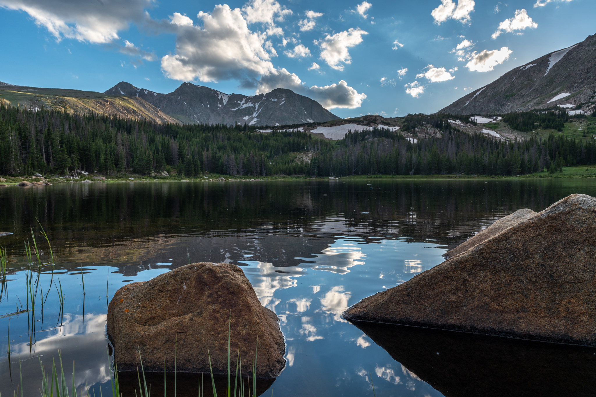
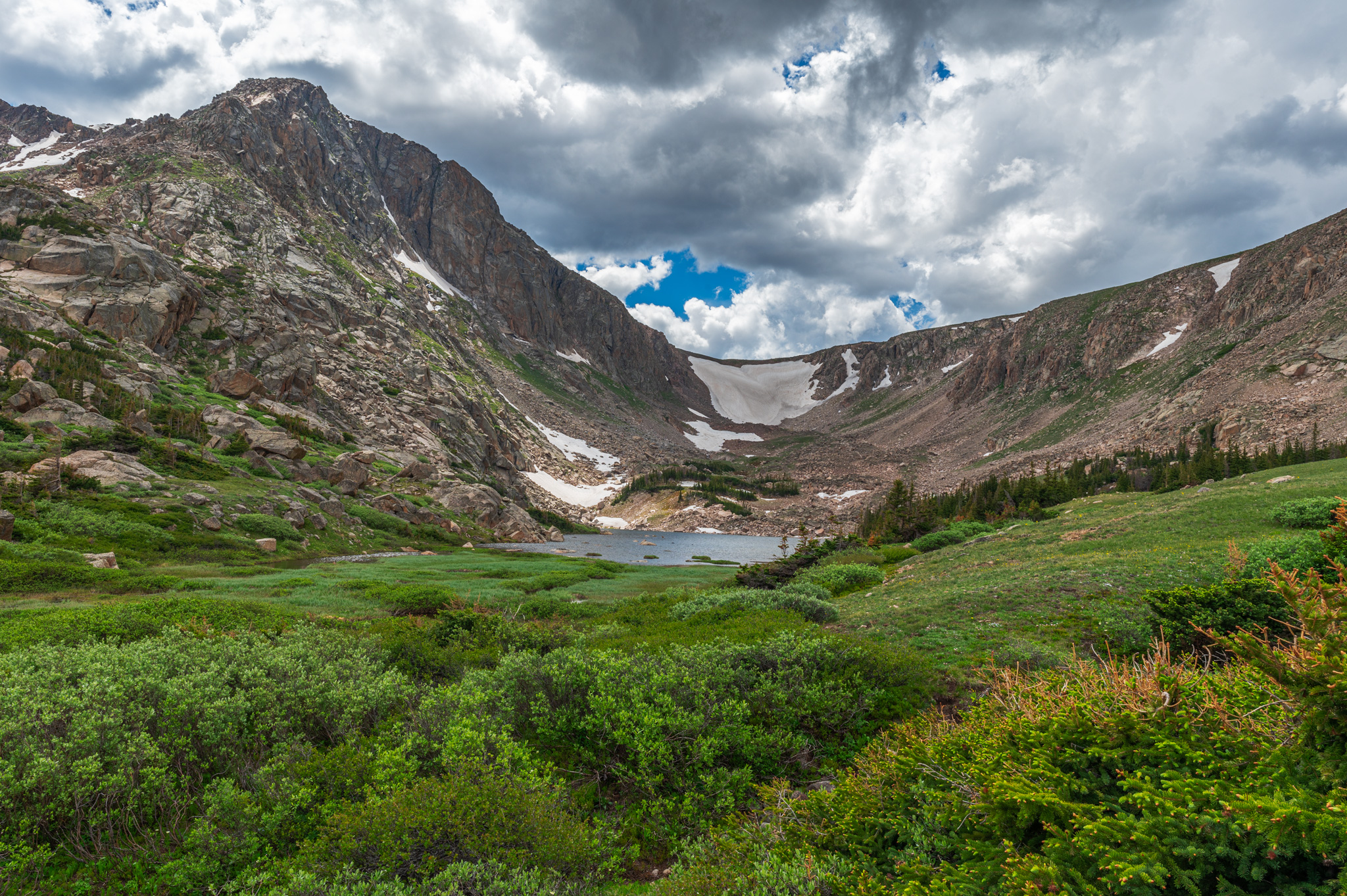
From Lost Meadows Campsite, a mere mile separated us from our final destination: Lost Lake. Just below the lake, the North Fork Trail splits into two camping areas, Lower Lost Lake and Upper Lost Lake. We opted to check out Upper Lost Lake first, taking a broken bridge across the drainage and continuing uphill. Upper Lost Lake campsite #1 is easy to spot off to the right, while the trail continues up past a privy to the second upper campsite.
We spent a while searching for campsite #2 but we were fatigued and hungry, and ultimately decided to stick with campsite #1. It took us just over 6 hours from the trailhead to reach Lost Lake, but we made several stops for video and photography purposes. Weather predictions called for rain between 1PM and 4PM but we received no precipitation, only a bit of rolling thunder and cloudy conditions.
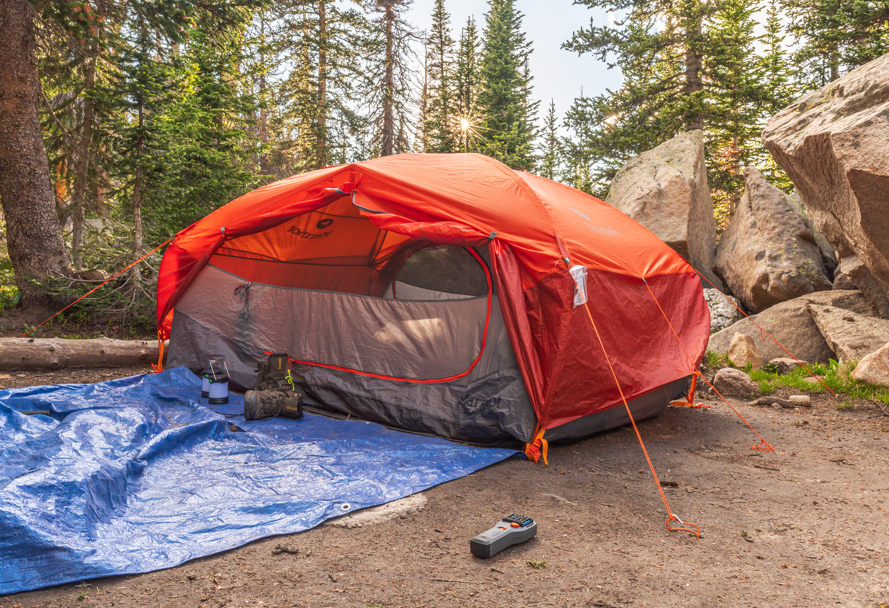
I was happy with our camping selection because it was a bit closer to Lost Lake and our water source, and the designated camping area was flat and free of rocks and roots. As soon as we began to unpack, however, we were immediately swarmed by flies. The flies did not bite, but they were annoying and super adamant about getting into our tent. Several flies got trapped and buzzed around for hours in between our tent and rain fly.
We theorized that the flies were attracted to bright colors, as they had little interest in our dark blue hammock and our darker hued packs, but they loved our vibrant orange rain fly. Once our marmot tent was assembled and our campsite was partially formed, we unpacked our bear canister and toted it down to the shore for our first visit at Lost Lake and lunch. Bear canisters are required when wilderness camping, and must be stored in a safe space 200 feet from the campsite.
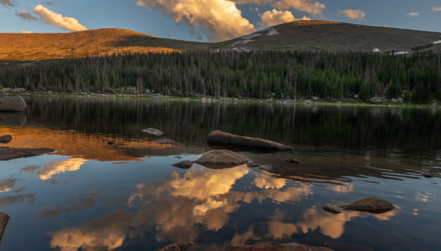
We noshed on a meal of mixed nuts, protein bars and beef jerky while exploring the surrounding area. The banks of Lost Lake are soggy with lake water and boulder hoping is required to keep ones feet dry. Other hikers already populated the lake – we were surprised to see day hikers on a round trip distance of over 19 miles. Many of the others at Lost Lake were fishing on the banks – cutthroat trout are abundant in the area. In Rocky Mountain National Park fishing is permitted but it’s catch and release only.
Hiking to Lake Husted and Lake Louise
We finished up lunch and wedged our bear canister near a large boulder. We were excited to start exploring the area and we made quick work of repacking supplies into our day packs. Dave recently purchased a Cotopaxi 24 liter day pack of his own and he’s already obsessed. Skirting left around the lake proved to be a difficult task with pools of water and wet conditions everywhere.
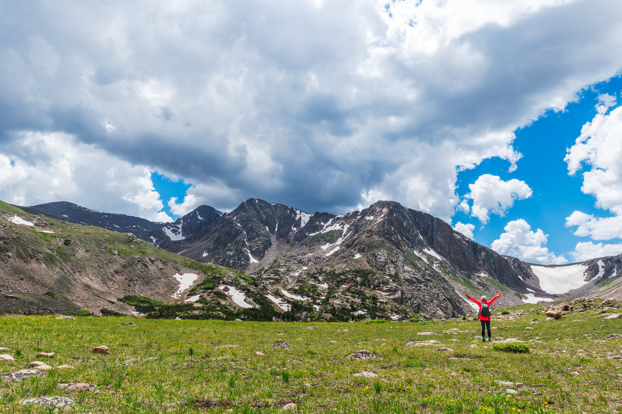
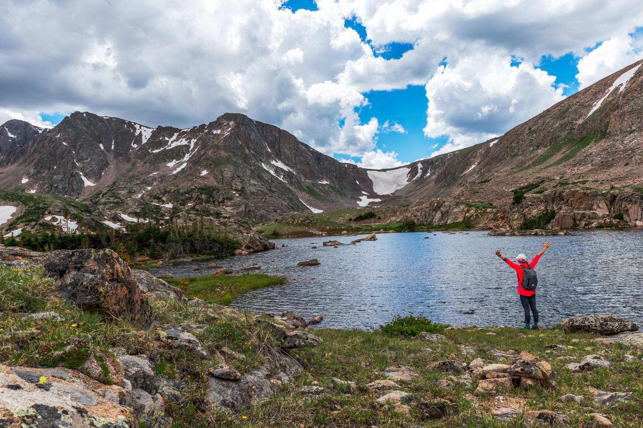
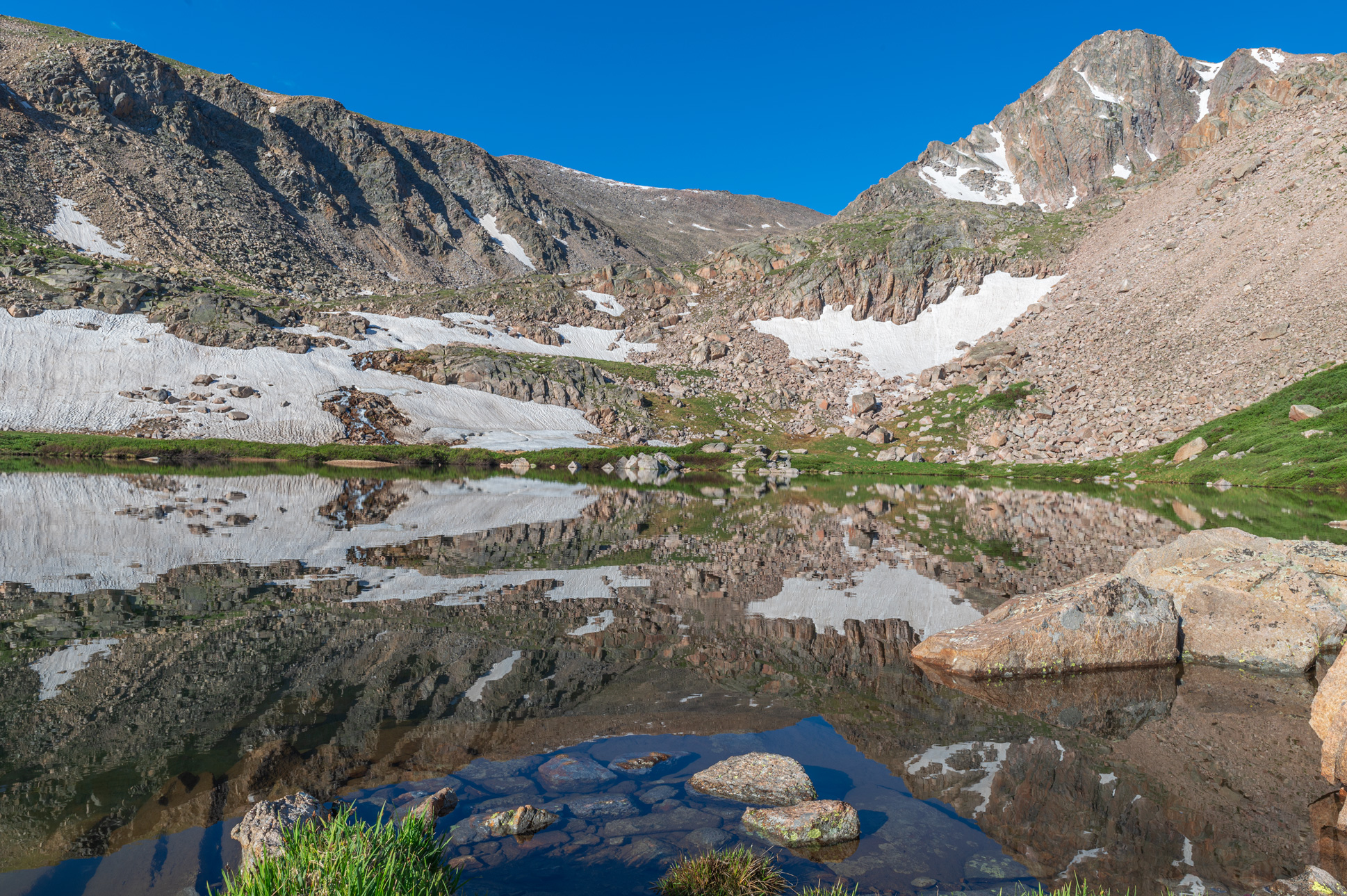
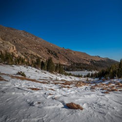
There is a social trail through the trees but on our first trip up we bushwhacked up through a boggy area and eventually rejoined the trail near the top of a hill hugging Lost Lake. From here, the terrain opens up considerably and it’s an easy jaunt over to Lake Husted. This horseshoe-shaped lake is a 0.5 mile hike from Lost Lake, with 300 feet of elevation gain. As we traversed over an alpine meadow, we spotted a male moose in a patch of bushes. When we saw him, he quickly took cover in thicker underbrush to hide, but he re-emerged a little later on. Lake Husted provides a good vantage point of Skull Pass – a snow covered Ridge between Sugarloaf Mountain and Skull Point. We discussed climbing this, but after seeing all the snow we realized it was unattainable.
From Lake Husted, we hiked left along the bank towards Lake Louise. There are both downhill and uphill segments in the 0.6 miles between the two lakes, and the elevation of both lakes is fairly even. To the left, we passed a series of unnamed ponds below before reaching the long, narrow silhouette of Lake Louise. It’s a chore to get directly on the banks due to dense bushes and wet conditions. We scrambled atop a rocky outcropping to snap a few pictures before heading back. On our return trip, we scouted potential routes to Lake Dunraven; there is a route on AllTrails but it is wildly inaccurate. There is absolutely no trail, social or otherwise, that leads to Lake Dunraven or any of the upper unofficially named lakes. We agreed that our hike tomorrow would require a lot of bushwhacking and route finding.
Returning to Camp
When we arrived back at the lake, other campers had staked a claim on Upper Lost Lake #2, while one other group occupied the Lower Lost Lake campsite. We retrieved the bear canister and busted out the jetboil to rehydrate our camp meals. Fires are banned in all backcountry sites, but with the jetboil, setup is easy and water boils in under 5 minutes. We brought our food along with photography gear back to the lake to eat and prepare for sunset. Dave set up the GoPro 9 to film a time warp and scoped out an ideal spot to snap sunset with the Nikon D780.
Regrettably there wasn’t much of a sunset to speak of, there was an absence of vibrant colors and clouds in the sky tonight. We packed up dinner and camera gear and headed back to camp to crash. Just as dusk fell another group of campers arrived at Lost Lake. Instead of taking the last available campsite in Lower Lost Lake, they camped “illegally” between our site and site #2. This wasn’t particularly bothersome to us, but it was annoying that rules weren’t adhered to, especially since they are put in place to preserve wildlife and restoration processes.
Lost Lake Wilderness Camping Day 2
Lake Dunraven and Beyond
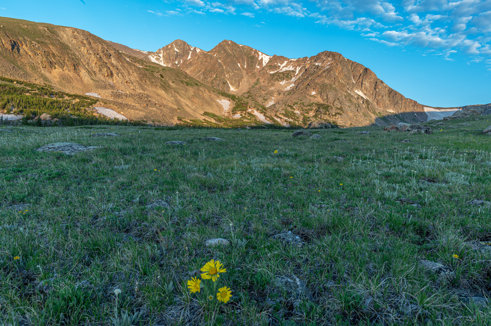
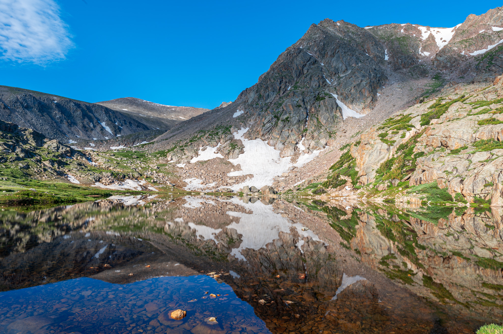
On day two, we rose early at 5AM to snag sunrise. Similar to last night, there were no clouds and the sunrise was lackluster. Birds were singing in full force, and Dave experimented with setting up a new microphone to capture background noise. We readied the day packs and set off in the direction of Lake Dunraven. This time around we took the social trail through the forest, then traversed across the alpine meadow.

The weather was in good shape and already warming up. We passed the scattered unnamed ponds and started searching for a reasonable creek crossing. In the warm weather, snow was melting quickly and the creek was flowing fast; we wasted a lot of valuable time looking for a creek crossing when we should’ve just stayed on the side we were and dealt with the bushwhack.

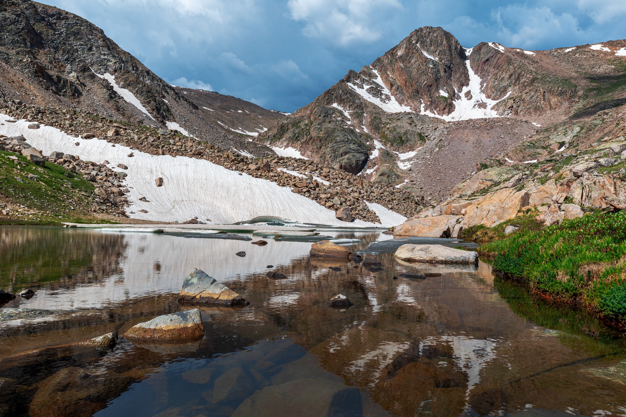
Finally, close to Lake Dunraven we were able to rock-hop across the water and scramble up the banks. Lake Dunraven (11,280 ft) is a 1.6 mile hike from Lost Lake and is flanked by Mount Dunraven. “Gilbraltar Peak” (13,400 ft) is a prominent feature in the background.
“Whiskey Lake” and “Scotch Lake”
From Lake Dunraven, we skirted the left bank and made our way up toward two unofficially named lakes; Scotch Lake and Whiskey Lake. Along Lake Dunraven the terrain is boggy and wet – it was hard to keep our toes dry. We also spotted signs of bighorn sheep in the area, lots of hoof prints and scat, but unfortunately we did not see any wildlife.
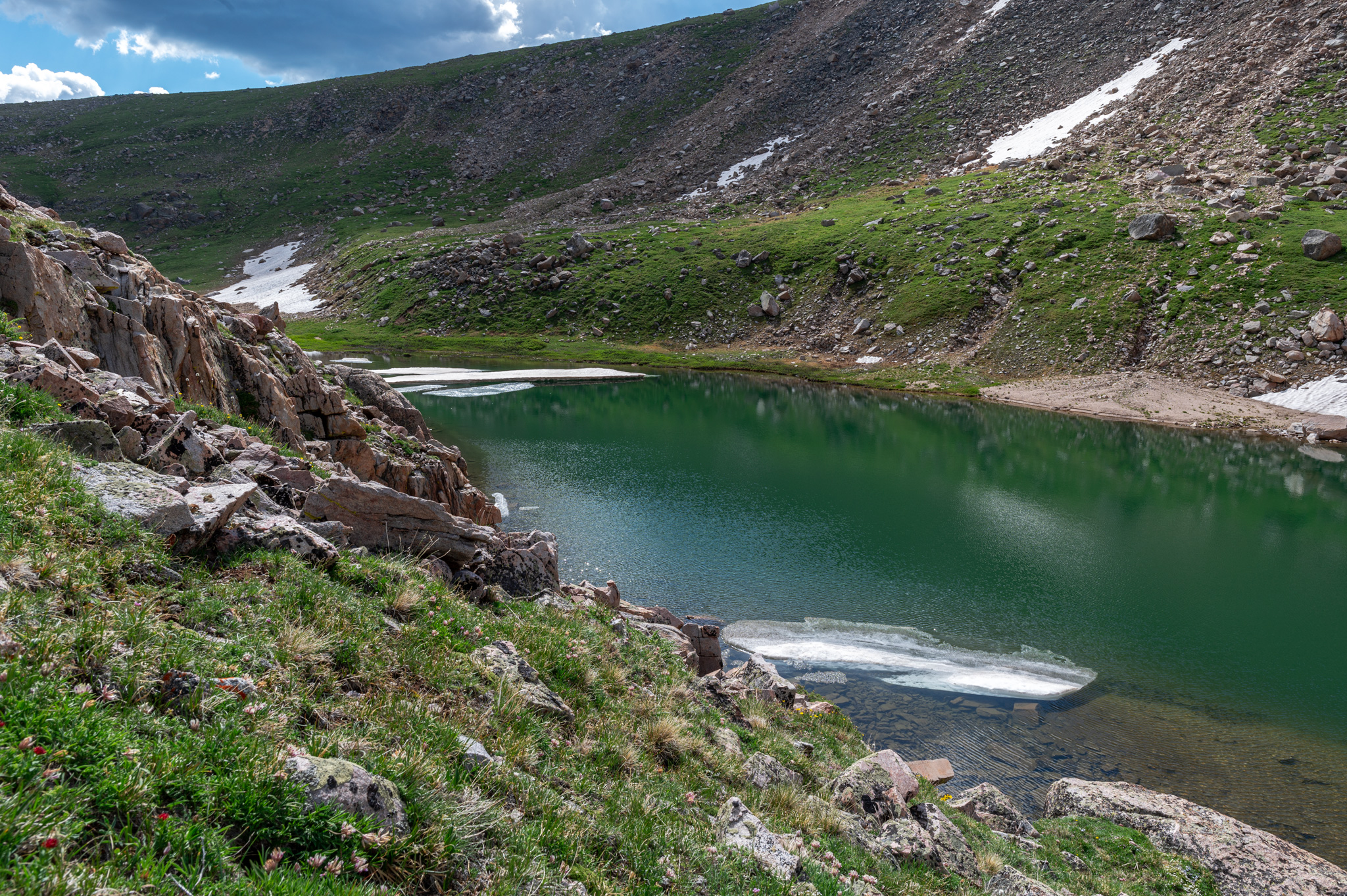
The hike up to Whiskey Lake (11,535 ft) is another half mile with 300 feet of elevation gain. The trek to Scotch Lake (11,624 ft) is a short 0.2 miles and 100 feet of elevation gain. But the two unnoficially named lakes could not be more different. Whiskey Lake is round and completely thawed. Whereas Scotch Lake is a thin finger that boasts huge slabs of ice floating in the water.
We crossed the drainage again here and hiked counter-clockwise around Scotch Lake in order to continue towards Rowe Glacier Lake. At this point, we could already tell the route would be problematic due to all the snow. We boulder hopped the 0.2 mile length of Scotch and scouted the terrain for a safe ascent up to Rowe Glacier. But precious time was wasted by taking a wrong turn and heading up the slopes of “Gilbraltar Peak”, after which we had to navigate across some sketchy boulder areas and a small patch of snow. We half glissaded down the snow and tried to navigate to the left and find a different route up.
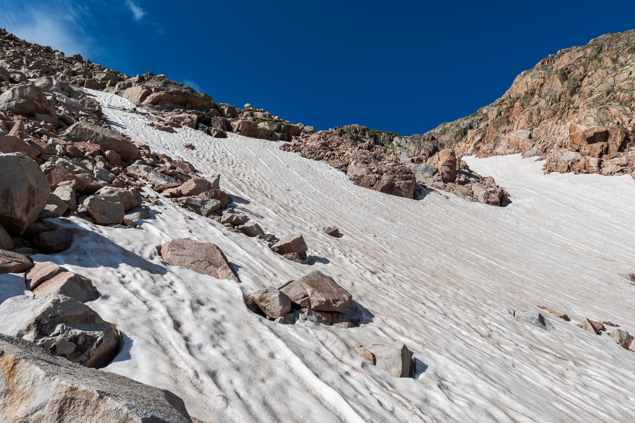
Hike Fail up to Rowe Glacier
A snowfield stretched across all potential routes up; as per the route described in Lisa Foster’s guide, we needed to follow the Big Thompson River drainage, but this was covered completely in show. With the dicey conditions, soft snow and steep inclines, we decided to turn around and hike-failed Rowe Glacier Lake. If we had crampons and ice axes the snow field could have been attainable, but it wasn’t in the cards today.
After turning around, we made our way back to Scotch Lake, and Dave celebrated the 4th of July with a shooter of whiskey on the shore. At this time, dark clouds started to race in over the mountains and we decided it was in our best interests to get back to Lost Lake before weather rolled in.
By the time we made it to Lake Dunraven we could hear thunder pealing on two sides. To avoid a difficult bushwhack on the return trip, we decided to find an alternate route and forgo our original creek crossing. This was not a good idea, as we ended up with a worse bushwhack, and conditions were very wet. Getting our shoes wet as we hiked was unavoidable. In addition, we fretted over potential lightning strikes and tried to stay below tree line.
Eventually, after making our way around the string of unnamed ponds, we were able to locate a crossing where we wouldn’t get completely drenched. We stayed close to tree line instead of walking out in the open tundra, and eventually reconnected with the social trail down to Lost Lake. Thunder was still threatening but there was no rain. After a total of 6 miles, 1,400 feet of elevation gain and 5 hours of hiking we were back at our campsite.
Day 2 Return to Lost Lake Campsite
The weather was clear enough at this time to take our bear canister down to the shore and have lunch. Other campers lingered by the lake fishing and taking in the views. After lunch we went back to the campsite to recoup, and this was a good idea because immediately after it started pouring and we had to take cover in the tent. The rain gave us temporary respite from the flies and mosquitoes, but they soon returned once the clouds cleared. I spent most of the afternoon reading by the lake, while Dave experimented with submerging the GoPro and recording sound clips. Soon the sun set behind the mountains and we prepped for dinner – more dehydrated meals. The sunset again this evening was not of epic scale, so we decided to turn in for the night.
Lost Lake Day 3 – Returning to the Trailhead
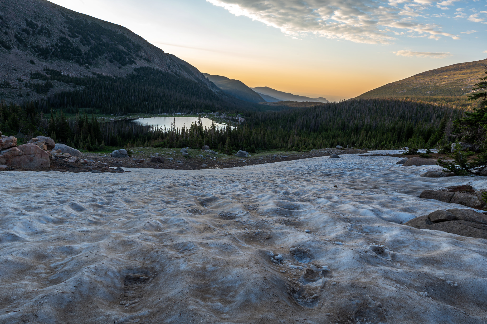
Monday morning we woke at 5AM and watched the sunrise before breaking down camp. I think we are getting more efficient at packing all our gear; we left the campsite around 6:30AM to make the 10 mile trek back to the parking lot. My body was still sore from carrying my pack into camp and it was mentally tough for me on the hike back. Our return trip proved to be quite eventful. An hour into our hike, we turned a corner and came face to face with two female moose walking toward us on the trail. All of us froze immediately, and the two moose eventually moved off the trail into the woods and we were able to continue on.
Lost Falls – off trail waterfall
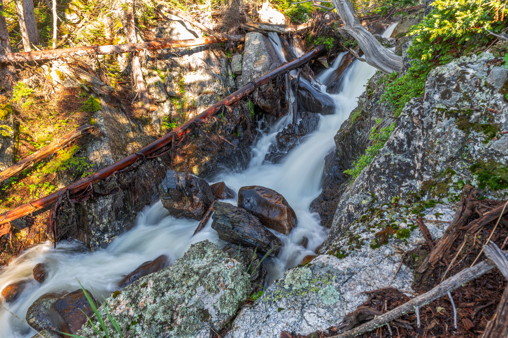
Roughly 0.2 miles from the Stormy Peak Trail junction, we dumped our packs and turned off trail to visit Lost Falls, which we bypassed on the trip in. It is a very steep decline to Lost Falls and the banks here at Big Thompson River are very dangerous; incorrect footing or an accidental slip could result in serious injury. Dave was careful to watch his foot placement trying to get a good angle of the falls. A lot of named falls in the park are hard to identify (Lyric Falls and Mertensia Falls, for instance), but Lost Falls made itself immediately apparent.
Though there is no trail, it’s easy to follow the sound of rushing water on the descent. As we climbed back up a bear poked its head over a rocky ledge and looked down at us. It was the first bear I’ve ever seen in the wild, but it didn’t stay for long, it was skittish and ran away – Dave didn’t even have time to snap a picture. I’m assuming it was a black bear since it wasn’t big, but its face was cinnamon in color. We were nervous the bear had messed with our discarded packs but when we returned everything was as we left it.
Our long return to Dunraven Trailhead
The trail on our return trip was a bit more waterlogged; this can be attributed to the amount of rain the area received the previous day. We left so early to hike out, we didn’t notice how many day hikers utilize the North Fork Trail, but on our return trip we passed several day hikers walking and fishing along Big Thompson River. Finally we reached the trailhead and high-fived it out; we were both ready for air conditioning, showers, and real human food. Our total time on the trip back was four and a half hours – not too shabby for a ten mile hike!
Other than the disappointment of not reaching Rowe Glacier Lake, we enjoyed our trip thoroughly and can’t wait to go camping again. Our next camping trip this summer will bring us to Yellowstone National Park for three days, followed by a two day stint in The Grand Tetons National Park.
Leave a Reply
You must be logged in to post a comment.