
One more Colorado 13er in the books for 2020, to break up the drive to Grand Lake we stopped at Berthoud Pass to tackle Mount Flora (13,127 ft). We departed from Denver at the luxurious time of 7:30AM, and arrived at the trailhead just before 9am. Weather conditions were ideal for mid-October and the parking lot was filling up fast.
Hiking Video of Mount Flora Summit and Flora Peak Trail
An unofficial shortcut cuts through the steep slope, but on the ascent we opted to stay on the heavily trafficked Mines Peak Trail. Colorado Mines Peak (12,392 ft) is often done in conjunction with Mount Flora; today we omitted it.

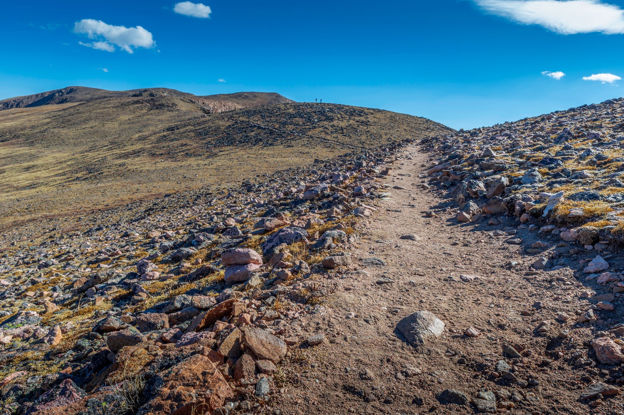
Hiking the Flora Peak Trail
Flora Peak Trail splits from the switch-backing Mines Peak Trail a mile from the trailhead; it is marked with appropriate signage. From here, the trail loops around Colorado Mines Peak and traverses a ridge. The trail slopes upward, but the elevation gain is manageable. This hike has potential for harsh winds, in fact, the first time I climbed this mountain the wind was relentless; today the elements were quiet.

The steepest part of the Flora Peak Trail occurs just after navigating the ridge, a push to a false summit of Mount Flora. After gaining the false summit, the true summit of Mount Flora can be seen to the right.

The trail slopes downward and then ramps back up to reach the true summit. During our walk, we shared the trail with other hikers and there were also lots of dogs on the trail, most of them off-leash. Nonetheless, the trail was well marked and well maintained.
The Summit of Mount Flora

At the summit of Mount Flora, a sign indicates the true summit and there are two wind blocks and several cairns. A path continues to nearby Breckenridge Mountain (12,865 ft) and there are great 360 views of surrounding peaks. Across Berthoud Pass stands Vasquez Peak (12,940 ft), while Witter Peak (12,855 ft) soars in the other direction.

Looking down into the valley, Ethel Lake and Byron Lake shimmer under the sun. The most direct route to nearby Colorado 13ers Mount Eva (13,131 ft) and Perry Peak (13,373 ft) stems from the Mount Flora Trail. Throughout the hike route 40 can be seen from above and occasionally moving cars can be heard, but the winding road is pleasant to look down upon.

We shared the summit with a handful of other hikers, relishing in the sun and lack of wind – the weather for this time of year truly was amazing, I recall I did Decalibron around the same time last year and it was snowing, windy and about 20°F. Snapping pictures and recording videos on the GoPro 9 was a must before heading down to the trailhead.
Hiking Back to Berthoud Pass

On the return trip, we skipped the heavily trafficked Mines Peak Trail and took a right instead on the unnamed shortcut. This path is steep and slippery, but it does shave off a decent amount of distance and time.
The parking lot caters to both Mount Flora and Berthoud Pass West Trail to Stanley Mountain (12,530 ft). We could see this trail from afar, and it seems comparable to Mount Flora. Other hikers perused the Mines Peak Trail, and more wandered the paved trails around the parking area; this happens to be a popular spot along the Continental Divide. Due to easy access to a plethora of activities, the parking lot fills quickly, especially on a nice Fall Saturday.
Mount Flora is an excellent hike to undertake as a beginner Colorado 13er and as an introduction to more difficult summit hikes. The trailhead is easily accessible and less than an hours’ drive from Denver along Route 40, I have summited this mountain twice and I enjoyed both equally. There are plenty of camping opportunities in the area for a weekend outdoors. Our hike statistics totaled to 6.5 miles round trip, with 1,781 feet of elevation gain.

Leave a Reply
You must be logged in to post a comment.