
A weekend in Bryce Canyon National Park, Utah. Date visited January 17th-19th. The Martin Luther King holiday weekend was well worth the 9 hour drive from Denver. The drive itself along route 70 makes for a photogenic trip through Colorado ski country, gradually changing to the mesa-ridden desert of Utah.

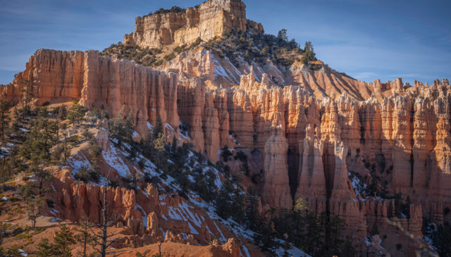
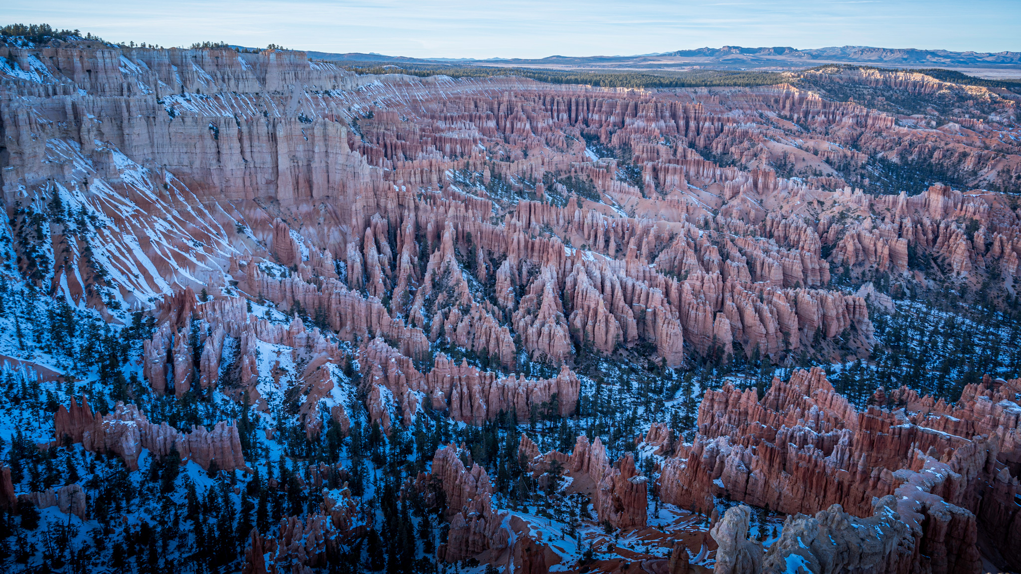
We cruised into Bryce Canyon National Park just in time for a 6pm sunset over Bryce Amphitheater. Sunrise Point and Sunset Point, separated by 0.5 miles of paved trail, are prime locations for watching “hoodoo glow” and changing colors on the horizon. We descended just below Sunrise Point along the Queens Garden Trail to capture last rays of light illuminating Bryce Canyon.
Several small motels and inns are scattered around the small town of Bryce; we scored a room at the Ruby Inn Best Western. This is a great central location in Bryce – no driving necessary to restaurants, grocery stores, souvenir shops and other local attractions. Furthermore, it’s a five minute car ride to Bryce Canyon National Park entrance. Between April and October, the Bryce Canyon shuttle bus frequents the Best Western and ferries visitors to various destinations in the park for no fee.
Peek-a-boo and Navajo Loops Hike in Bryce Canyon
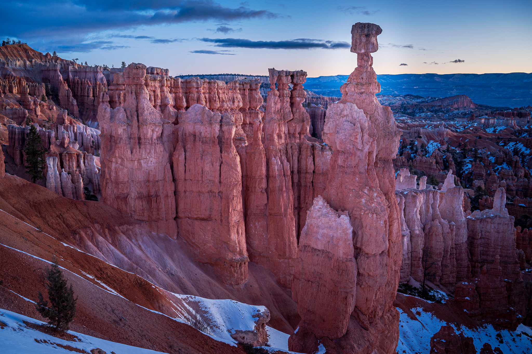
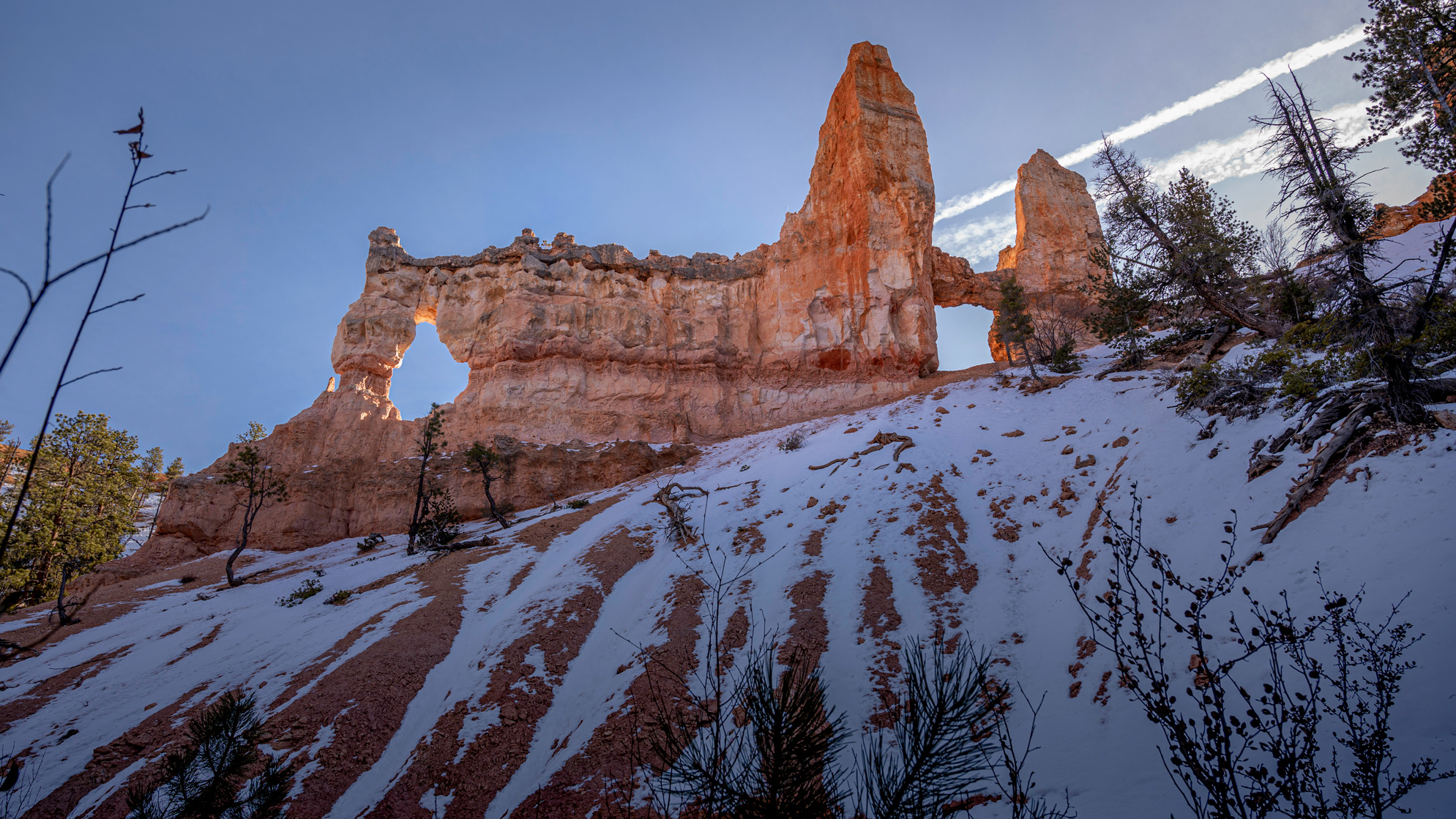
It was back to Sunset Point to catch sunrise over some of the most famous hoodoos in Bryce Canyon. From the maze of packed spires and fins, Thor’s Hammer rises in isolation, making it a popular destination. Sunlight angled into the canyon brings to light the vibrant red, orange and yellow colors of the Silent City of hoodoos. From Sunset Point, a series of switchbacks descend to the canyon floor. Wall Street Trail was closed during our visit, but the Navajo Loop is a worthy alternative.
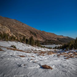
In the morning during colder temperatures, solid ice pack makes the trails slippery, but by mid-morning conditions are slushy and traction is not needed. We turned to go counter-clockwise along the Peekaboo Loop Trail from the Navajo Trail. Appropriate signage eases navigation.
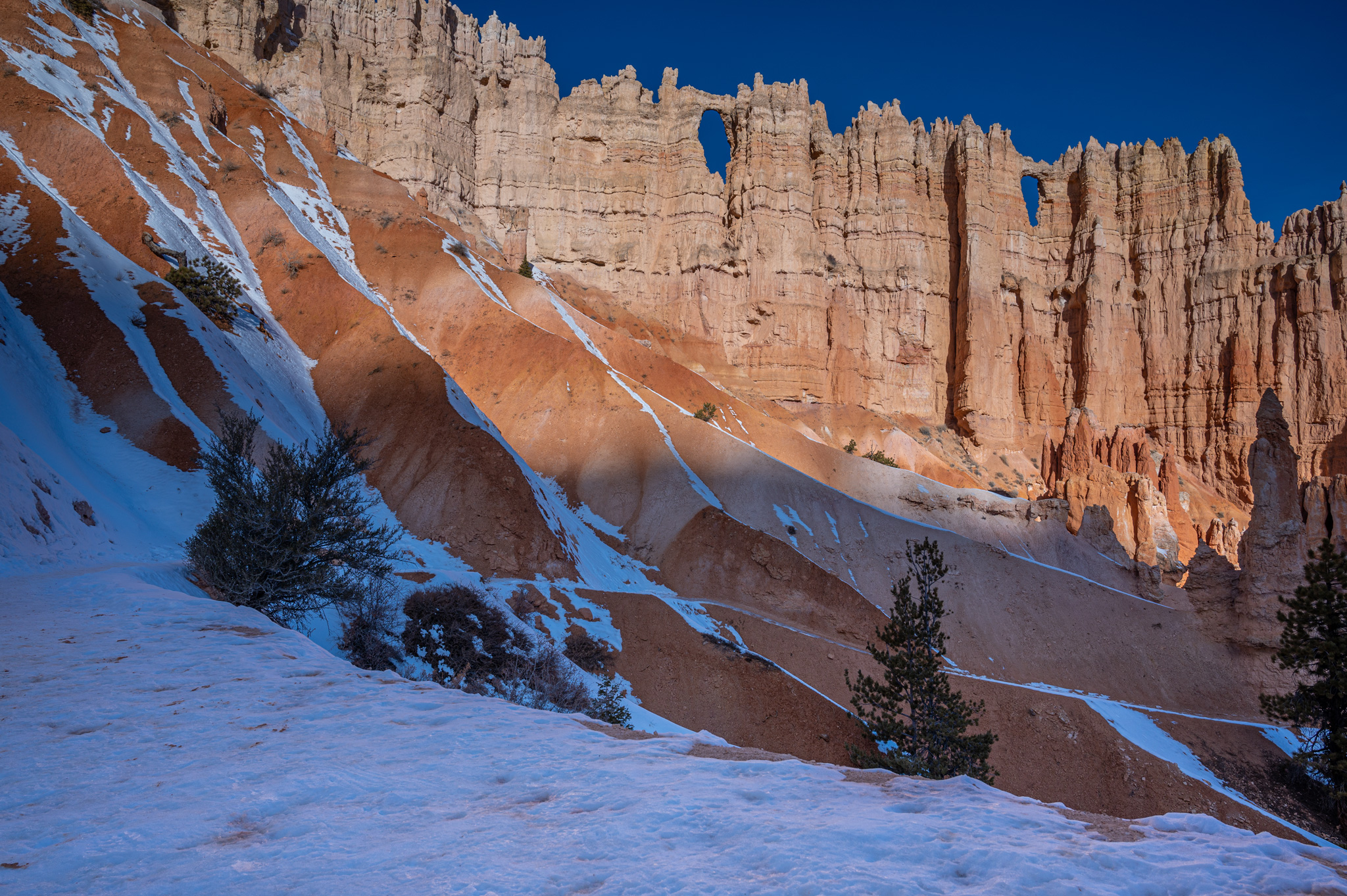
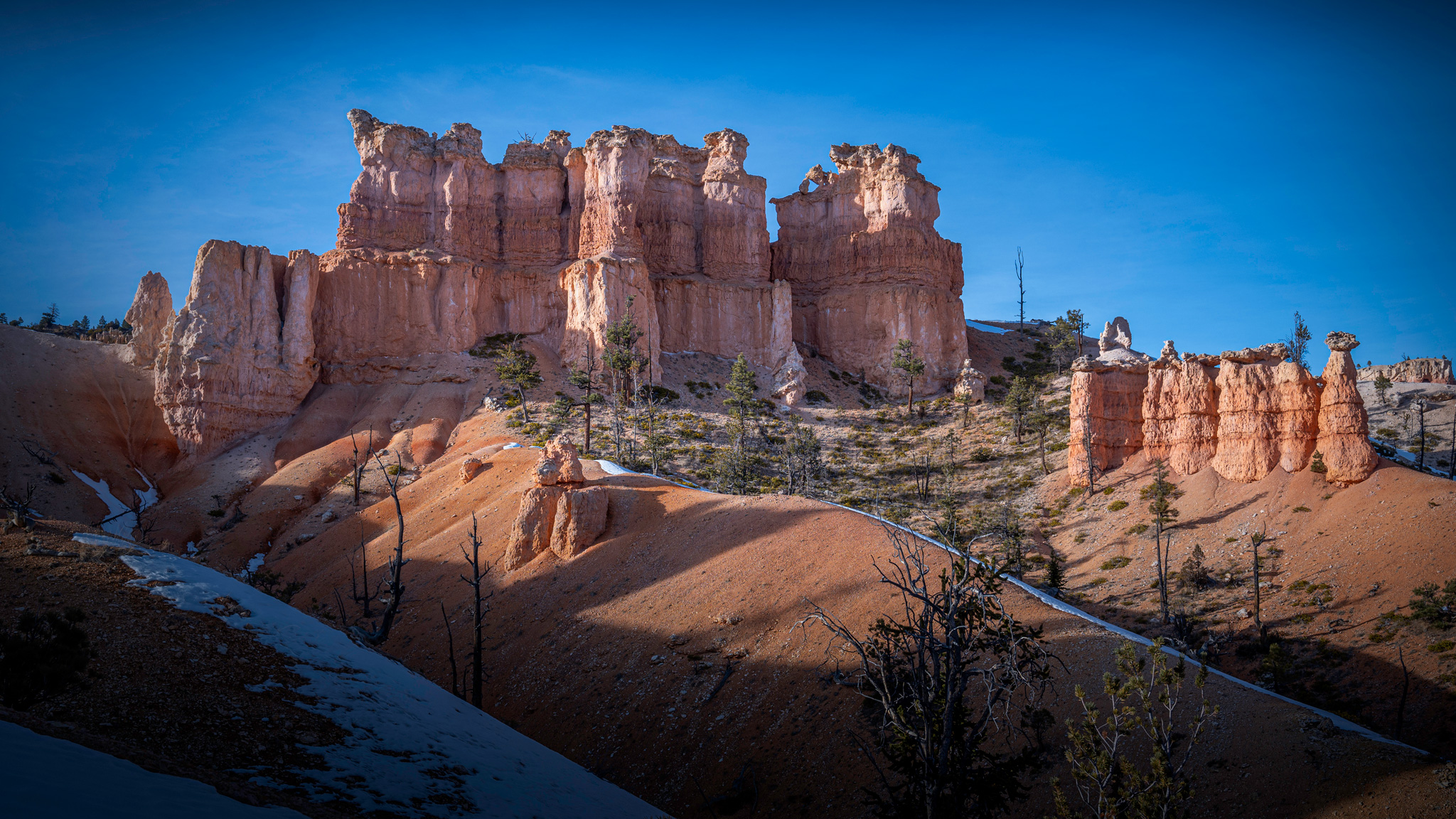
Multiple switches in elevation gain and loss along this trail account for its difficulty rating, but the scenery is well worth it. Unique rock formations rise on all sides, the most notable being the Wall of Windows, Hindu Temples and Peekaboo Arch. There is a bathroom on the trail, but it was locked up for the winter. The trail itself is diverse, while the continued freezing and thawing of water gives the hoodoos a melting effect.
While on the Peek-a-boo Loop, we encountered 15 other hikers, but as we neared the junction of Queens Garden Loop, we began to see crowded trail conditions. This 1.6 mile strings together Navajo and Queens Garden Trails and is one of the most popular in the park. Make sure to take a 0.1 mile excursion to get a close up view of the Queen Hoodoo and her royal court. It was quite the contrast from Colorado trails; the rigorous elevation gain occurred at the end of the trail.
Hiking Stats for Peek-a-Boo and Navajo Loops
Hiking Distance:
Total Elevation Gain:
7.69 Miles Loop
1,689 ft
Fairyland Loop Hike in Bryce Canyon

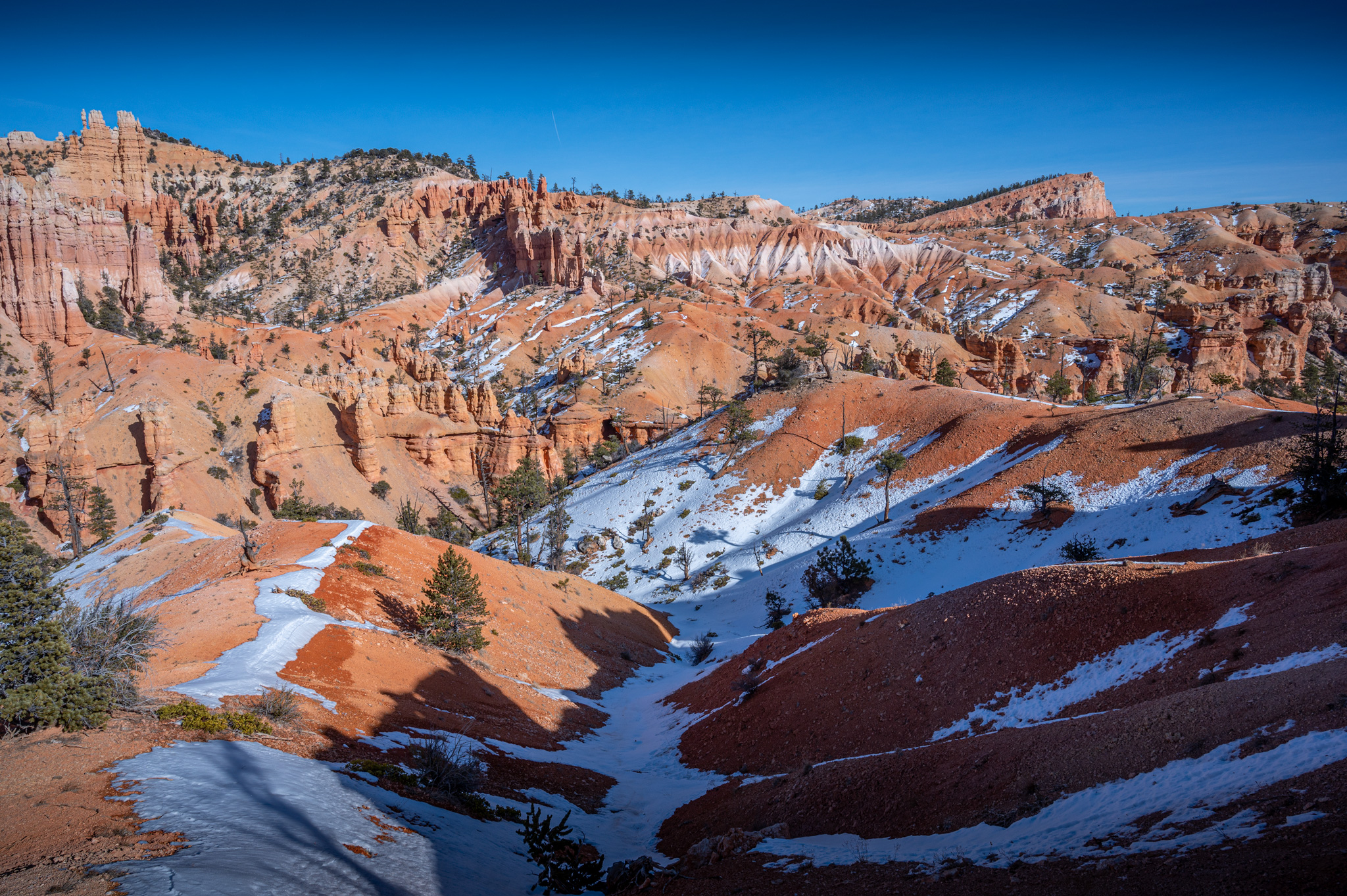
At noon we stopped for a lunch break, then drove to the Sunrise Point parking lot to begin our second hike of the day: Fairyland Loop. The Fairyland Loop trailhead parking is closed for the winter, but it can be accessed from the Rim Trail by adding extra mileage. The Rim Trail is flat and uneventful – I would suggest doing this leg of the journey first. After 2 miles, a sloping trail to the canyon floor signifies the beginning of Fairyland Trail and an increase in scenery. This trail is much less traveled than Navajo, Queens Garden and Peekaboo options, there were long stretches of solitude on this trail even during peak hiking times.
Must-see destinations on Fairyland Loop include Boat Mesa, Sinking Ship, Crescent Castle, Oastler Castle and Tower Bridge. I would suggest completing the whole loop, but Tower Bridge can be accessed by traveling counter clockwise on the Fairyland Trail for 1.3 miles (one way) if time is limited. Similar to Peekaboo Loop, the trail was diverse and surrounding views did not disappoint. In the warming afternoon temperatures the trail had become muddy in areas and our pant legs were worse for the wear post-hike.
Hiking Stats for Fairyland Loop in Bryce Canyon
Hiking Distance:
Total Elevation Gain:
8.53 Miles Loop
1,624 ft
After cranking out two lengthy hikes in Bryce Canyon, a total of 15 miles with 3,000 feet of elevation gain, it was an hour until sunset and exhaustion was setting in. Bryce Canyon National Park is home to an 18 mile scenic drive from the entrance gate to Rainbow Arch. Several scenic overlooks veer off the main road and we figured we had just enough time to visit Bryce Point, the highest elevation marker in the park.
During summer months when the shuttle is operational, hikers can enjoy Under the Rim Trail, a 23 mile distance one way.
From Bryce Point parking lot, it’s a short descent to a fenced-in overlook – this parking area also plays host to an alternate way to Peekaboo Loop and to the trailhead of Hat Shop Trail. Wind began to pick up over the hoodoos which made for a chilly visit, but it was apparent this would make a fine sunrise/sunset location. The Bryce Point Trail is heavily trafficked and as a result is quite slippery.
It was back to Sunrise Point to catch the last rays of our twelve hour day in Bryce Canyon National Park. The light gleaming on the hoodoos steals the show, but the pink/purple sky contouring peaks in the background is a stunning view as well. Finding an unlocked bathroom in the park was rare, make sure to plan accordingly, especially in the heavily trafficked areas where privacy is scarce.

Mossy Cave Hike in Bryce Canyon National Park
We completed one final 1 mile hike in Bryce Canyon National Park the next day: Mossy Cave. This hike is overlooked due to its displacement from the main area of the park, but it’s a great little jaunt for hikers of all abilities. The limited trailhead parking is located just outside of Tropic, Utah. Mossy Cave Trail parallels Tropic Ditch until reaching a bridge; here the path splits, left goes to Mossy Cave while a right leads to an overlook of Turret Arch and a waterfall.
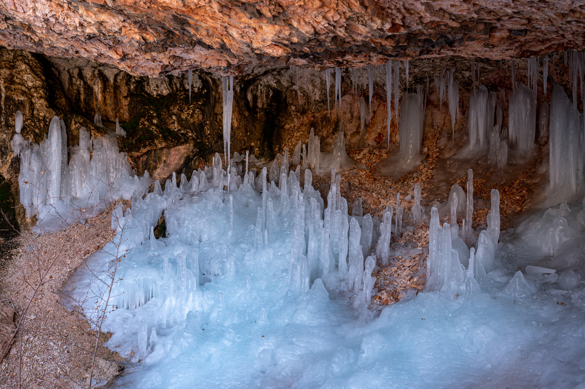
Mossy Cave in winter is filled with dripping icicles, some of which do not melt until July. A gated trail wedges itself under the right side of the cave for a closer look. We circled back to check out waterfall overlook, then hopped into the frozen creek bed to walk directly up to the waterfall. The outer casing of the squat waterfall was a slushy ice and the ice sheet is separated from the rock wall behind, I was able to crouch behind it. Trail conditions at Mossy Cave are icy, but can be done without extra traction as the elevation gain is negligible.
Leave a Reply
You must be logged in to post a comment.