
Snow fell overnight on Grand Lake and Rocky Mountain National Park on October 11th 2020. On our final day of hiking, Trail Ridge Road was closed between the Colorado River Trailhead and Rainbow Curve. This did not deter us from driving US 34 until a few yards before the closure – Timber Creek Trailhead. After our 20 mile hike to visit all five lakes along East Inlet Creek, we scaled back with an 11 mile hike to Timber Lake. 5:30AM marked our arrival time at the trailhead and we bundled up to face cooler temperatures.
Video of our Hike to Timber Lake
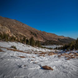
Hiking the Timber Lake Trail
Headlamps were a must as we moved through an aspen grove, then up through a forest of pine. The elevation gain was moderate at best and the walk through the woods was pleasant and quiet. As it neared the break of dawn, a purple glow was cast on the Never Summer Range through the trees, producing a charming sunrise. Due to tree cover, Dave was unable to find a suitable overlook on which to take a sunrise shot – next time we will take caution to plan our hikes more thoroughly.
In the half light, we reached the most dangerous portion of the hike 2.5 miles in; the landslide. Loose rock and dirt covered the trail, and unstable conditions felled several mature trees in the area. According to posted warnings, the landslide was active, meaning it could shift at any moment. Cautious as we were with footing, water that had solidified made for slippery circumstances. The landslide does not continue for long, 20 feet perhaps, but I can see why hikers often turn back at this juncture.
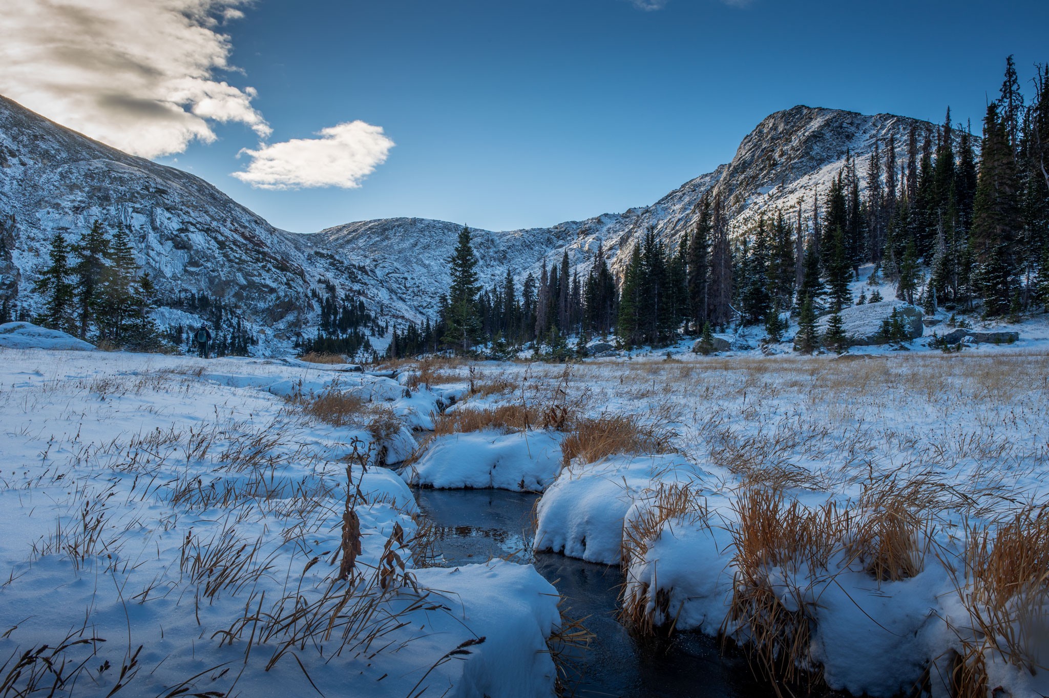
Sunrise at Timber Creek

The Timber Lake trail continues through dense forest until uniting with Timber Creek. Here, an unmaintained trail deviates across a bridge for 0.8 miles to Long Meadows, while Timber Lake Trail follows a steep left through switchbacks for 1.7 miles. Timber Creek was flowing freely, but ice crystals had taken root on surrounding rocks and branches; we would make sure to capture this footage on the return trip.
Timber Lake Trail switchbacks along Timber Creek the remainder of the journey to the lake. At this higher elevation, we encountered more snow on the path, six inches to a foot in some areas, though microspikes were unnecessary. Though a separate trail branches off for Long Meadows, we experienced a pristine meadow ourselves – unofficially named ‘Jackstraw Meadow’ due to its proximity to overlying ‘Jackstraw Mountain.’ Elevation-wise, the final stretch of the trail is the most difficult. A few large trees blocked our ascent, but we climbed over or under with ease; it was nothing compared to the felled trees between Spirit Lake and Fourth Lake yesterday.
Arriving at Timber Lake

At the 5.4 mile mark, we reached Timber Lake (11,060 ft). Trees protected us on our ascent, but now in the open we were introduced to biting winds. Despite the cold, Timber Lake was a vision, especially with fresh snow blanketing surrounding peaks, and ice building on the shoreline.

Mount Ida can be seen to the east, while unofficially named ‘Jackstraw Mountain’ flanks the south side of the lake. We took an abbreviated break at Timber Lake for photography; our toes were quickly growing cold.

Return Hike to Timber Creek Trailhead
On our descent, we circled back to the multitude of small cascades tumbling down Timber Creek. Ice crystals surrounding the flowing water made for excellent contrast. At the intersection of Long Meadows Trail, we met other hikers on the trail, our first company of the day. After passing back through the landslide, the trail became increasingly trafficked, though it is nothing compared to hikes on the Estes Park side (Emerald Lake or Mills Lake to name a few). Several hikers asked if we had seen wildlife, leading me to believe moose and elk are frequently spotted here; unfortunately we encountered no wildlife today.

An unnamed waterfall along Beaver Creek indicated our final stopping point. A mass of small cascades tumbled over rocks, and Dave stopped to set up compositions. From here it’s a brief walk back to the parking lot. In order to reach Timber Lake, we logged in 11 miles and 2,470 feet of elevation gain. It’s been quite some time since we completed a hike less than 15 miles in the park, at the end we were hardly tired. Timber Lake marks our 53rd visited lake in Rocky Mountain National Park; less than 100 left to reach our goal!
Leave a Reply
You must be logged in to post a comment.